The challenge of being efficient delivering parcels in large cities

Carry a package to the destination selected by the user entails a detailed logistic process that for modern times and those ahead, will require greater precision of the technology to geolocate parcels and destinations, selecting the best possible routes.
The main and secondary urban centers of each country are growing rapidly, both in terms of population, infrastructure, and transportation; therefore, the demand for services is not only greater but also implies extra specific requirements, according to the needs of human beings of this era, where time is valuable.
Within ten years the world population will have increased by one billion, which will mean a considerable increase of people per square meter in the cities, making the delivery of parcels a great challenge for the geolocalization of the users who contract services to the home.
What are the advances to date?
Logistics services use technological tools such as GPS and geolocation of platforms such as Google Maps to identify packet delivery sites, but overcrowding has meant that these tools are constantly evolving so that the service is really efficient, convenient and expedite for the customers.
In the search to guarantee delivery on time and eliminate the obstacles that prevent satisfactory deliveries in the last part of the route, where the exact address must be distinguished among hundreds of places in a small space, systems such as the what4words platform have emerged, example.
What4words divided the world into millions of coordinates based on spaces of 3 by 3 square meters that are identified each meter with a word from the dictionary. This way any address in the world has a unique trackable name.

![]()
El reto de ser eficientes entregando encomiendas en las grandes ciudades

Llevar un paquete hasta el destino seleccionado por el usuario conlleva un proceso logístico detallado que para los tiempos modernos y los venideros, requerirá mayor precisión de la tecnología para geolocalizar encomiendas y destinos, seleccionando las mejores rutas posibles.
Los principales y secundarios centros urbanos de cada país están creciendo aceleradamente, tanto en población como en infraestructura y transporte; por lo tanto, la demanda de servicios no solo es mayor, sino que implican requerimientos específicos extras, acordes a las necesidades de los seres humanos de esta época, donde el tiempo es valioso.
Dentro de una centena de años la población mundial habrá aumentado en mil millones lo que significará un incremento considerable de personas por metros cuadrado en las ciudades convirtiendo la entrega de encomiendas en un gran reto para la geo localización de los usuarios que contratan servicios hasta el hogar.
¿Cuáles son los avances al día de hoy?
Los servicios logísticos utilizan herramientas tecnológicas como el GPS y la geolocalizacion de plataformas como Google Maps para identificar los sitios de entrega de paquetes pero la sobrepoblación ha implicado que estas herramientas sigan en constante evolución para que el servicio sea realmente eficiente, cómodo y expedito para los clientes.
En la búsqueda de e impiden las entregas satisfactorias en la última parte del trayecto, donde se debe distinguir la dirección exacta entre cientos de lugares en un pequeño espacio, han surgido sistemas como la plataforma what4words, por ejemplo.
what4words dividió al mundo en millones de coordenadas basadas en espacios de 3 por 3 metros cuadrados que se identifican cada metro con una palabra del diccionario. De esta forma cualquier dirección del mundo cuenta con un nombre único rastreable.
100 Responses

lxbfYeaa
555
lxbfYeaa
555
lxbfYeaa
555
lxbfYeaa
1
lxbfYeaa
1
lxbfYeaa
555
lxbfYeaa
555
lxbfYeaa
555
lxbfYeaa
1
lxbfYeaa
1
lxbfYeaa
555
lxbfYeaa
555
lxbfYeaa
555
lxbfYeaa
555
lxbfYeaa
555
lxbfYeaa
555
lxbfYeaa
555
lxbfYeaa
1
lxbfYeaa
555
lxbfYeaa
1
lxbfYeaa
555
lxbfYeaa
555
lxbfYeaa
555
lxbfYeaa
555
@@pP1I3
1
1'"
1
lxbfYeaa'||DBMS_PIPE.RECEIVE_MESSAGE(CHR(98)||CHR(98)||CHR(98),15)||'
1
lxbfYeaa
555
dYnuCU2j')) OR 565=(SELECT 565 FROM PG_SLEEP(15))--
1
lxbfYeaa
555
GDVD5V1r') OR 279=(SELECT 279 FROM PG_SLEEP(15))--
1
lxbfYeaa
555
R2FJmowv' OR 542=(SELECT 542 FROM PG_SLEEP(15))--
1
lxbfYeaa
555
rfbjr6E9'; waitfor delay '0:0:15' --
1
lxbfYeaa
555
1 waitfor delay '0:0:15' --
1
lxbfYeaa
555
(select(0)from(select(sleep(15)))v)/*'+(select(0)from(select(sleep(15)))v)+'"+(select(0)from(select(sleep(15)))v)+"*/
1
lxbfYeaa
555
0"XOR(if(now()=sysdate(),sleep(15),0))XOR"Z
1
lxbfYeaa
555
0'XOR(if(now()=sysdate(),sleep(15),0))XOR'Z
1
lxbfYeaa
555
if(now()=sysdate(),sleep(15),0)
1
lxbfYeaa
555
lxbfYeaa
555
lxbfYeaa
555
lxbfYeaa
555
lxbfYeaa
555
lxbfYeaa
555
lxbfYeaa
1
lxbfYeaa
1
-1" OR 2+80-80-1=0+0+0+1 --
1
-1' OR 2+240-240-1=0+0+0+1 or 'XDXJTG2N'='
1
-1' OR 2+208-208-1=0+0+0+1 --
1
-1 OR 2+334-334-1=0+0+0+1
1
-1 OR 2+430-430-1=0+0+0+1 --
1
lxbfYeaa
1
lxbfYeaa
555
lxbfYeaa
1
lxbfYeaa
1
lxbfYeaa
1
lxbfYeaa
1
lxbfYeaa
1
lxbfYeaa
1
lxbfYeaa
1
lxbfYeaa
1
lxbfYeaa
1
lxbfYeaa
1
lxbfYeaa
1
lxbfYeaa
1
lxbfYeaa
1
lxbfYeaa
1
lxbfYeaa
1
lxbfYeaa
1
lxbfYeaa
1
lxbfYeaa
1
lxbfYeaa
555
lxbfYeaa
1
lxbfYeaa
1
lxbfYeaa
1
lxbfYeaa
555
lxbfYeaa
1
lxbfYeaa
@@Brv5Q
lxbfYeaa
1
����%2527%2522
lxbfYeaa
1’"
lxbfYeaa
1
lxbfYeaa
555’||DBMS_PIPE.RECEIVE_MESSAGE(CHR||CHR||CHR,15)||’
lxbfYeaa
1
lxbfYeaa
1
lxbfYeaa
555*DBMS_PIPE.RECEIVE_MESSAGE(CHR||CHR||CHR,15)
lxbfYeaa
1
lxbfYeaa
66K3aZL5’)) OR 863=(SELECT 863 FROM PG_SLEEP(15))—
lxbfYeaa
1
lxbfYeaa
JVn6La6h’) OR 550=(SELECT 550 FROM PG_SLEEP(15))—
lxbfYeaa
1
lxbfYeaa
pKwLEswY’ OR 72=(SELECT 72 FROM PG_SLEEP(15))—
lxbfYeaa
1
Leave a comment
Also in News
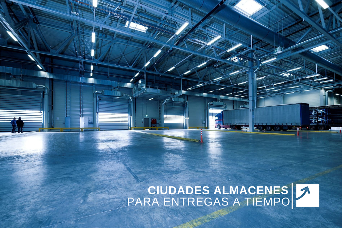
Ciudades almacenes para entregas a tiempo
De esta forma, los servicios logísticos tienen frente a ellos un gran reto del mundo moderno. Nuevos métodos de almacenaje son requeridos, ahora que las grandes ciudades tienen menos espacios para el resguardo de encomiendas, pero que deben ser entregados a tiempo evitando colapsos.

Una tendencia que crece: Comprar desde y hasta el hogar
Conociendo este escenario de ascenso para las compras por internet y como efecto de esta gran revolución comercial, los servicios logísticos requieren ampliar su capacidad para ofrecer almacenaje y distribución...

El Canal de Panamá abre un acceso público a la información
La trascendencia histórica desde que el primer barco recorría el Canal de Panamá ha permitido ver la evolución de un país y el comercio que utiliza esta conexión para mejorar tiempos, costos de traslado de cargas, y por ende, la economía mundial.
lxbfYeaa
May 19, 2022
555